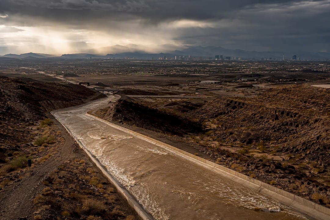
The definitive way to know whether a Las Vegas property sits inside a flood zone is to run its exact address through the FEMA Flood Map Service Center, which returns the official FIRM panel, flood zone designation, and effective date. Even a "minimal risk" result deserves a second look: this valley's monsoon-driven flash floods have caused damage well outside FEMA's mapped high-risk boundaries. Before writing an offer, pull the FEMA report yourself and ask the seller or listing agent for a FIRMette and any elevation documentation on file.
TL;DR:
- Most flash floods occur during mid-summer monsoon months, with intense storms capable of overwhelming drainage systems in hours.
- Sheet-flow can impact properties far from mapped floodways, especially during stalled storms in flat desert terrain.
- Recent upstream development can alter drainage patterns more quickly than FEMA's map updates reflect, increasing flood risk.
- Flood insurance is mandatory for properties in high-risk zones with federally backed mortgages, but premiums vary based on elevation and proximity to water sources.
- Complete due diligence includes collecting FEMA maps, elevation certificates, inspecting for water damage, and consulting hydrologists for homes near washes or recent grading permits.
Table of Contents
- How Do You Check Flood Zones in Las Vegas?
- Why Is Flood Risk in Las Vegas Different From Other Cities?
- Do You Need Flood Insurance for a Las Vegas Home?
- What Should Buyers Check Before Closing?
- How a Local Agent Applies Flood Data to Luxury Purchases
- Flood-Risk Review as Part of Your Las Vegas Home Search
- Where to Verify Flood Maps and Local Infrastructure
- Sources
- FAQ
How Do You Check Flood Zones in Las Vegas?
Confirming a property's flood zone designation takes about ten minutes if you know where to look, and every serious buyer should do it before the inspection period, not after.
- Search the address on the FEMA Flood Map Service Center. Enter the full street address at FEMA's MSC portal and note the FIRM panel number and its effective date. Panels get revised over time, and an older effective date can mean the mapping predates recent drainage work in the area.
- Generate a FIRMette. This is a printable, georeferenced excerpt of the official flood map, and it's the document lenders and insurers actually want to see. On it, look for the zone letter (X, A, AE, AO), any shaded high-risk boundary crossing the parcel, and whether a Base Flood Elevation (BFE) number appears near the property.
- Cross-reference the DFIRM dataset when the FIRMette is ambiguous. The underlying Digital Flood Insurance Rate Map database for Clark County holds the raw risk classifications, including the 1%-annual-chance and 0.2%-annual-chance boundaries that FIRM panels are built from.
- Check the Clark County Regional Flood Control District. CCRFCD tracks detention basins, channels, and capital projects that FEMA's maps may not yet reflect. A neighborhood with a new detention basin completed after the last FIRM revision may carry lower real-world risk than its official zone suggests, or vice versa if development upstream has added runoff.
Save every screenshot, PDF, and metadata line from these searches. Escrow officers, lenders, and insurance underwriters will all ask for this exact paperwork, and having it ready shaves days off closing.
Why Is Flood Risk in Las Vegas Different From Other Cities?
Las Vegas sits in a desert basin, and that geography changes how flooding behaves compared to a coastal or river-adjacent city. There's no slow-rising river here. There's monsoon season, typically running July through September, when intense, short-duration storms drop more rain in an hour than the ground and municipal systems can absorb.
The mechanism that catches buyers off guard is sheet-flow: water moving as a broad, shallow sheet across flat terrain rather than staying confined to a marked wash or channel. A property can sit a quarter mile from the nearest mapped floodway and still take on water during a heavy monsoon cell, because the desert surface simply can't drain fast enough once storm cells stall over a neighborhood.
Development compounds the issue. Paved roads, rooftops, and driveways don't absorb rain the way native desert soil does, so newer subdivisions built upstream from an older neighborhood can quietly increase that neighborhood's runoff exposure, even when no map has been redrawn yet. This is exactly why FEMA itself cautions that many flood insurance claims originate from outside officially mapped high-risk areas.
- Monsoon season peaks July through September, with the most intense flash-flood events typically hitting in a matter of hours.
- Sheet-flow can affect properties with no visible wash, channel, or creek anywhere nearby.
- Recently developed areas upstream can shift drainage patterns faster than FEMA's map revision cycle keeps up.
Pro Tip: Ask the county flood control district whether any detention basin or channel project near the property was completed after the FIRM panel's effective date. A basin built in the last few years can meaningfully change a parcel's real exposure even when the official zone hasn't been updated.
Do You Need Flood Insurance for a Las Vegas Home?
Flood insurance becomes mandatory the moment a property with a federally backed mortgage falls inside a Special Flood Hazard Area, the zones FEMA labels A, AE, or V. These represent land with at least a 1% annual chance of flooding, the threshold FEMA uses to define high risk for lending purposes nationwide. Fall outside that boundary and a lender generally won't require coverage, though nothing stops a buyer from purchasing it voluntarily.
Under the National Flood Insurance Program's Risk Rating 2.0 methodology, premiums are no longer set by zone letter alone. Pricing now factors in distance to the nearest water source, ground elevation relative to it, and local drainage characteristics, which means two homes in the same zone can carry different premiums.

Base Flood Elevation matters here in a very concrete way: a home built below the BFE typically pays more, while one elevated above it can qualify for meaningfully lower rates, sometimes enough to justify requesting an elevation certificate before making an offer.
Before you're locked into a contract, take these steps:
- Request the seller's flood claim history, if any exists, in writing.
- Get a preliminary flood insurance quote from at least one carrier before your inspection period closes.
- Order an elevation certificate for any property near a wash, channel, or Zone A/AE boundary.
A number worth remembering: any parcel FEMA classifies with a 1% annual chance of flooding is officially high risk, the same 1-in-100 standard used to trigger mandatory insurance on federally backed loans nationwide, per FEMA's flood map guidance.
What Should Buyers Check Before Closing?
A flood zone lookup is the starting point, not the finish line. The due diligence that actually protects a buyer happens on the ground and in the paperwork trail.
- Pull the full document set. Collect the FIRMette, the underlying FIS/FIRM panel, any existing elevation certificate, the seller's property disclosure, HOA drainage plans if applicable, and permit history for grading or fill work.
- Walk the lot at grade. Look for low spots, staining or discoloration near the foundation, and any evidence of past water intrusion in the garage or crawl space.
- Check proximity to washes and drainage easements, even ones that look dry and unremarkable most of the year.
- Bring in a civil engineer or hydrologist for any property near a mapped wash, a recent grading permit, or a history of neighborhood flood complaints.
- Negotiate before you waive contingencies. Remediation credits, seller-funded elevation certificates, or an escrow holdback tied to permit remediation are all reasonable asks when flood documentation raises questions. If the numbers shift materially, revisiting a seller's net proceeds calculation helps frame a credible credit request.
Treat these as hard stop signs: no flood documentation available at all, repeated insurance claims on the property, unpermitted fill dirt that appears to redirect runoff toward a neighbor, or unresolved drainage complaints on file with the county.
Pro Tip: If a seller can't produce a FIRMette or elevation certificate within a few days of request, that delay itself is information. Legitimate paperwork on a well-maintained property is almost always on hand or easy to pull.
How a Local Agent Applies Flood Data to Luxury Purchases
Flood-risk due diligence on a seven-figure property demands more precision than a standard transaction, and that's where experienced local representation earns its keep. Compiling FEMA data alongside CCRFCD project history, then sourcing a hydrologist when a parcel sits near a wash, is standard practice for any purchase where the stakes are this high.
Negotiation leverage often follows directly from what that research uncovers. A missing elevation certificate, an unpermitted grading change, or a claim history the seller hadn't disclosed can justify a credit, a remediation timeline, or a conditional close tied to further inspection. For out-of-state buyers relocating to Las Vegas, that same diligence extends into concierge coordination, arranging engineers, surveyors, and inspectors before ever setting foot on the property, and drawing on off-market inventory when a promising listing's flood profile doesn't clear scrutiny.
— Yelena
Flood-Risk Review as Part of Your Las Vegas Home Search
Flood-zone verification can be incorporated into luxury real estate transactions, not as an afterthought after the offer is written, but before it. That means a property-specific FEMA and CCRFCD review, help securing a FIRMette or elevation certificate, and negotiation grounded in what the flood data actually shows, rather than what a listing sheet claims.

For out-of-state buyers, relocation concierge support can extend diligence across the entire move, from planning a cross-country relocation to coordinating inspections before seeing the home in person. When a property's flood profile raises concerns, off-market access may open doors that a public listing search might not, potentially leveraging global networks. Flood exposure isn't unique to Las Vegas, either. Buyers weighing similar transaction risk in other markets can see how it plays out in Miami's closing cost considerations for a useful outside comparison.
Ready to evaluate a specific address? Visit YH Luxury Homes to start a flood-risk review alongside your property search, or to discuss off-market options if a listing's flood history gives you pause.
Where to Verify Flood Maps and Local Infrastructure
- FEMA Flood Map Service Center: official address-level flood zone lookup.
- Clark County Regional Flood Control District: local basins, channels, and drainage projects.
- First Street's Las Vegas flood report: broader climate-risk context beyond FEMA zones.
Sources
- FEMA Flood Map Service Center (MSC)
- Fema
- Clark County Regional Flood Control District
- Digital Flood Insurance Rate Map Database, Clark County, Nevada (AmeriGEOSS DataHub)
FAQ
What Is the Fastest Way to Check Flood Zones in Las Vegas?
Enter the property address directly into the FEMA Flood Map Service Center to get the official zone designation, FIRM panel number, and effective date in minutes.
Are Properties Outside Mapped Flood Zones Still at Risk?
Yes. Sheet-flow flooding during monsoon season can affect land with no nearby mapped wash, which is why FEMA itself notes that many claims come from outside high-risk zones.
Is Flood Insurance Required for Las Vegas Homes?
It's mandatory for federally backed mortgages on properties in Special Flood Hazard Areas (Zones A, AE, or V), and voluntary elsewhere, though FEMA recommends considering it regardless of zone.
What Does the Clark County Regional Flood Control District Do?
It manages the valley's detention basins and drainage channels, infrastructure that materially affects a neighborhood's real flood exposure beyond what a FEMA map alone shows, according to CCRFCD.
Can Yhluxrealestate Help With Flood-Risk Review Before I Buy?
Yes. Yhluxrealestate incorporates FEMA and CCRFCD data review, elevation certificate coordination, and flood-informed negotiation into its buyer representation for Las Vegas properties.